Posts

Santa Monica Airport

Image
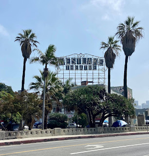
This route explores Santa Monica's lesser know east side. The main attraction is the airport and its observation deck. I like to pick up some take out, usually at Chutneys, to enjoy while watching the planes. The airport is slated to close in 2028 so don't dilly dally. Before you go - The 6 mile route is mostly flat. The only challenge is the distance. The airport alone is worth checking out if you don't want to do the walk. I think it would be a good place to bring kids. There is plenty of street parking and a restroom near the start. The Metro E Line (Expo) is not far. Starting there will add about a half a mile to the route.  There are restrooms in the parks and at the airport (but none at Chutneys). Santa Monica's public restrooms are generally clean.  This pedestrian passage under the 10 freeway looks a lot scarier than it is. You'll pass several vintage restaurants and businesses. I have seen kitties on this route, but not always. This one on Pico may be the o...

Glendale Bakery Crawl and Museum of Neon Art

Image
Walking and eating are two of my favorite pastimes. On this 5 mile you'll do plenty of both. Glendale is known for its Armenian bakeries; there are eleven on this route so pace yourselves. Sharing is key. Bring a knife. More than sweets this crawl centers on Armenian style flat breads - lahmajune, beorek, and manaish - that are filled or topped with cheese, za'atar (a Middle Easter mixture of herbs, spices, and sesame seeds), spinach, or potato. But don't pass on the sweets, try some of them too. Mid-walk you can take a break from eating while you visit the Museum of Neon Art. Before you go - The 5 mile route is mostly flat. Due to the high number of stops it's hard to say how long it will take to complete. Give yourself plenty of time.  The Museum of Neon Art is only open Fri.-Sun. noon to 7pm. Some of the bakeries are closed on Sundays. Fridays or Saturdays are the best days to go.  Start hungry, but don't overdo it at the first stop.  There is street parking on t...

Pomona Part 1 - Ganesha Park

Image
This route takes you to Pomona's oldest home and oldest park. It's only 3.5 miles but can easily be combined with my 5 mile Downtown Pomona route to make the most of your trip out east.             Before you go - The first part of the route is flat and easy. The second half starts with a long uphill climb followed by a descent back to the start.  Parking is available at the start. There is a public restroom in the park but it is often in bad shape and there are no doors on the stalls. If you are coming from far away I recommend a quick pit stop at nearby Brackett Field Airport. The restroom there is clean and easy to access. In fact, while your at it, enjoy breakfast and some plane watching at Norm's Hanger Coffee Shop before your walk. You might get lucky and see one of the feral cats that live in the park.  Casa Primera tours are available. Reservation required.  A series of semi-abandoned stairways take you to the wild side of the p...

El Segundo

Image
The 50 year old welcome sign has been removed. A new one is slated to take its place.  The new welcome sign was installed in 2025  Despite being surrounded by an oil refinery, a sewage treatment plant, LAX, and the 405 freeway El Segundo is worth a visit. You'll discover charming neighborhoods and a vibrant downtown with restaurants, breweries, eclectic shops, and one of my favorite places on earth - The Old Town Music Hall home of the Mighty Wurlitzer theater pipe organ. There is also a small park with an excellent view of the airport that is popular with plane spotters. You could easily spend a day here walking, watching planes, eating, and taking in a classic movie. Before you go - The 4.5 mile route is easy with only a few uphill inclines. There is plenty of street parking near the start.  There are public restrooms at the park where the walk starts and in the library around the 2 mile point. If you're walking in the morning Smoky Hollow Roasters and The Bread Bar a...

Westlake (MacArthur Park)

Image
Westlake, one of L.A.'s most densely populated neighborhoods, is best explored on foot. This 7 mile mostly flat walk showcases the area's rich assortment of architecture. The route is not entirely without hills and does include one stairway. I would say that and the distance make it a moderately challenging endeavor. One of the advantages of walking in such a bustling area is the abundance of places to grab a bite to eat and rest your feet. It just so happens that the iconic  Langer's  Deli is at the halfway point of the walk. Before you go - The distance and a couple of hills make this route moderately challenging, but there is so much to see that you will probably go at a leisurely pace. Street parking is available near the start/finish.  The only public restroom I know of is at the library about 3 miles in. Open porta-potties are rare in this area. You will have to rely on businesses and may need to make a purchase. I usually see more cats than I can count along the ro...

The Red Lion Tavern Loop

Image
 This challenging 4.5 mile loop takes you through the stairway intense neighborhoods of Silver Lake and Echo Park. It starts and ends at The Red Lion Tavern on Glendale Blvd where you can enjoy a post-hike reward of German food and beer.  Before you go - This is a challenging route with multiple stairways, mostly up, and hills.  If it's open I recommend using the restroom at the Silver Lake Branch Library near the start as there are no public restrooms along the route. Be on the lookout for open porta-potties or, if in dire need, make a detour at Echo Park Ave. to Lady Bird Cafe. They have been friendly when it comes to letting hikers use theirs in the past.  ❗The fourth stairway, Loma Vista Pl. on the Echo Park side of the 2 freeway turns into a dirt path at the top that leads to more stairs. See photos.❗ The route is usually good for a cat spotting or two. Continue along the dirt path.. until you see these stairs. This first stairway on the route, Loma Vista Pl., i...

Sierra Madre

Image
Sierra Madre We have the good fortune to live close enough to what may be the most charming city of the San Gabriel Valley to be able to walk there at least once a week. It's a unique urban hike that, if you're lucky, may include multiple wildlife sightings. We've seen deer, bobcats, and even a couple bears. Even if you don't see any wild animals you'll likely see two domesticated tortoises and many cats. We see one friendly cat so often that I've included him on my map. If you go in the morning you can have breakfast or lunch at Mary's Market in the heart of the canyon. Towards the end of the walk be sure to stop at E. Waldo Ward & Son to pick up a jar of preserves from this 100 plus year old business. Map of Sierra Madre Before you go -  The first part of the walk is challenging with many hills in the first 3 miles. The remainder is mostly flat. ❗The route includes a ladder (see photo below). Sometimes after a storm in may be lying on the ground and yo...